 By Staff
The Infrastructure Factor: How Municipal Planning Redefines Neighborhood Value in 2026
When it comes time to buy or sell a home, most people start by looking at the immediate numbers: recent comparable sales in the neighborhood, the square footage of the property, and the current condition of the roof. While these are critical data points, they only tell the story of a neighborhood’s past and present. They rarely account for the invisible, external forces shaping a community's future: municipal planning and local infrastructure.
Standard price-history tools and traditional real estate metrics operate like a rearview mirror. But long-term neighborhood value, the kind of value that builds generational wealth and ensures a high quality of life, ties directly to forward-looking civic investments. In the 2026 housing market, understanding local government plans is just as important as knowing your home's square footage.
New transit expansions, municipal electric vehicle (EV) charging networks, and zoning updates for commercial development fundamentally change the local economy. These objective, fact-based infrastructure projects alter traffic patterns, improve daily accessibility, and create a long-term value trajectory that raw historical data simply cannot predict.
For modern homeowners and homebuyers, translating these complex municipal records is no longer optional; it is necessary for accurate financial planning and smart real estate decisions.
The Limitations of the Rearview Mirror: Why AVMs Miss the Mark
To understand why infrastructure matters so much, we first have to understand how most real estate platforms calculate home values. The majority of real estate portals rely on standard Automated Valuation Models (AVMs). An AVM uses mathematical algorithms to evaluate public record data, such as tax assessments and past sales of similar homes in your area, to generate a baseline price.
While standard AVMs provide a helpful starting point, they are inherently limited by their reliance on historical data. An AVM can't "read" a city council agenda. It doesn't know that a major commercial developer just received approval to build a massive tech hub three miles away. It doesn't factor in the city's newly funded, multi-year initiative to transform a congested, multi-lane arterial road into a pedestrian-friendly boulevard.
Because standard AVMs can't interpret qualitative data or municipal planning documents, they often misprice homes sitting directly in the path of major economic shifts. They might undervalue a neighborhood on the verge of a transit-driven renaissance, or overvalue a property sitting in the immediate path of a disruptive, multi-year highway expansion that will introduce severe noise pollution. To truly understand a neighborhood's trajectory, you have to look beyond the algorithm and examine the infrastructure blueprints.
The Commuter Premium: Transit Expansions and Accessibility
One of the most significant drivers of long-term property value is accessibility, and in 2026, accessibility is increasingly defined by public transit infrastructure. When a municipality commits to a major transit expansion, such as a new light rail extension, a dedicated rapid transit bus corridor, or a modernized commuter train station, the surrounding real estate inevitably shifts.
A planned light rail extension three blocks from a residential neighborhood can signal future demand long before the first track is laid. Real estate markets are forward-looking. Investors and savvy homebuyers begin pricing in the convenience of that future transit stop the moment the municipal funding is approved.
This "commuter premium" transforms the neighborhood dynamic. Properties within a 10-to-15-minute walk of a new transit hub typically see a steady increase in buyer demand, particularly among younger professionals and downsizing empty-nesters who prioritize walkability and want to reduce their reliance on personal vehicles. However, it requires a nuanced understanding of the plans. A home situated a convenient half-mile from a new rail station will likely see a value boost, but a home backing right up to the newly constructed tracks might suffer from noise pollution, lowering its appeal. Understanding the exact municipal blueprints is key to navigating these shifts.
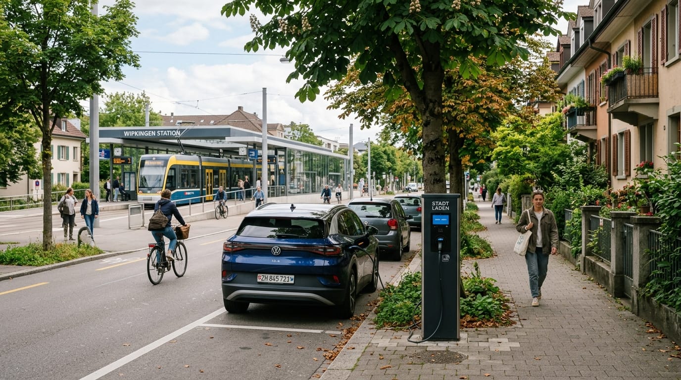
The 2026 Amenity: Municipal EV Charging Networks
As we move deeper into the 2020s, the automotive landscape has fundamentally changed, and local infrastructure is racing to catch up. Electric vehicle adoption has reached record highs, making EV infrastructure a top-tier neighborhood amenity.
While many homeowners install private chargers in their garages, municipal planning regarding public EV networks plays a massive role in a neighborhood’s overall appeal and long-term value. Neighborhoods where the local government has aggressively integrated high-speed public charging stations into street parking, local parks, and community centers are highly sought after.
This is especially true in older neighborhoods with dense housing, historic districts, or areas with a high concentration of townhomes and condos where private garage space is limited. In these communities, a city's commitment to curbside EV charging infrastructure isn't just an eco-friendly perk; it is a vital utility. When a city announces a multi-million dollar grant to blanket a specific zip code with upgraded power grids and public fast-chargers, it signals a modernization of the neighborhood that attracts forward-thinking buyers and drives up the baseline property values.
Zoning Updates and Commercial Horizons
Perhaps the most complex, yet impactful, municipal documents are local zoning codes. Zoning dictates what can and cannot be built in a specific area. A simple vote at a city council meeting to update zoning laws can redefine a neighborhood’s future overnight.
Consider the impact of "mixed-use" zoning. If a municipality rezones a declining industrial strip near a residential neighborhood to allow for mixed-use commercial and residential development, the trajectory of that neighborhood changes instantly. What was once a corridor of empty warehouses can become a vibrant, walkable hub of cafes, boutique grocery stores, and modern apartments.
For the homeowners living a few streets over, this zoning change is a massive windfall. Their neighborhood's "walkability score" will eventually skyrocket, bringing increased buyer demand and higher property values. Conversely, if a municipality rezones a nearby area for heavy industrial use or high-density logistics centers, the resulting increase in commercial truck traffic can negatively impact the appeal of surrounding residential streets.
Tracking these zoning updates allows homebuyers to identify "sleeper" neighborhoods—areas that are currently affordable but are legally primed for an influx of new amenities and commercial investment.
Real Estate Data, Translated
Navigating city council minutes, transit development blueprints, and complex zoning proposals is a daunting task for the average person. Most homebuyers and sellers simply don't have the time or the specialized knowledge required to interpret municipal planning records and apply them to their financial strategies.
That's where the eppraisal Agent comes in. We believe that every property decision should be backed by deep understanding, rather than just raw numbers.
Our AI Reasoning Engine acts as your personal "Expert Translator." We go beyond standard price-history tools by auditing hyper-local data points, including municipal planning, zoning laws, and infrastructure projects, and translating them into clear, plain-English narrative insights. We help you understand the "why" behind community shifts, providing the qualitative context and Estimated Property Valuations you need to make informed, confident real estate decisions in 2026 and beyond.
Share This Article

Join our newsletter!
Enter your email to receive our latest newsletter.